Nature and History in the Klamath Basin
by Stephen Most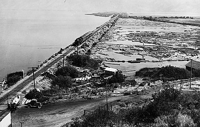
Divided Waters
The Klamath River system is unique in having Indian reservations at its headwaters, along its estuary, and astride its major tributary, the Trinity. Ever since the 1908 U.S. Supreme Court Winters decision, the federal government has acknowledged that Indian treaties, which guarantee hunting, fishing, and gathering rights, give tribes unique and senior rights to water within their territories.
The Klamath Project drained lakes and built a series of dams and canals in the Upper Basin nonetheless, disregarding Indian water rights throughout the twentieth century. The last of the project’s dams made no provision for wild salmon. Built in 1964, Iron Gate blocked spring chinook, the mainstay of the downriver tribes, from reaching their spawning habitat in the Upper Basin.
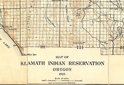
The termination of the Klamath Reservation in 1954 impacted the upriver tribes’ mullet or sucker fishery. Wetlands decreased as ranchlands expanded. Effluents increased with each new herd.
In spite of termination, a 1984 federal court case determined that Klamath Indians are entitled “to as much water on Reservation lands as they need to protect their hunting and fishing rights.” Yet when the reservation was restored in 1986, one of the first actions of the tribal government was to halt their own mullet fishery; for the survival of the species was in jeopardy.
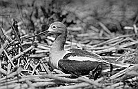
What made the Klamath Project take notice of the fishery’s decline was not Indian water rights but the Endangered Species Act. Fishery biologists employed by the Yurok and Hupa tribes downriver and by the Klamath Tribes at the headwaters contributed to scientific studies of wild coho salmon and the two species of sucker, both of which were listed under the ESA. In 2001, biological opinions concerning the condition of these species and their water needs pressured the Bureau of Reclamation to cut off water deliveries to the Klamath Project.
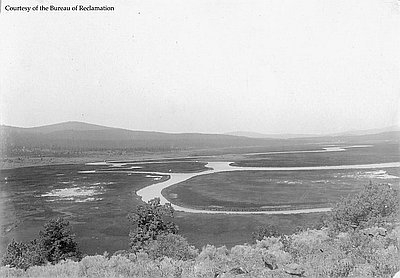
The waters of the Klamath River, its headwaters and tributaries, irrigate fields from California’s San Joaquin Valley to the Oregon highlands north of Upper Klamath Lake. Farmers cultivate the valleys of the Trinity, the Scott, and the Shasta—rivers that flow into the main stem downstream of the dams. But most of the farming within the Klamath drainage occurs near the headwaters, in the highlands known as the Upper Basin.
Also within the Upper Basin are farms in the Lost River drainage, which includes Tule Lake. These waters are considered part of the Klamath River system in spite of their origin. Not only do they irrigate Klamath Project fields but the Project, which built the dams, sumps, canals, and other facilities that move and store Upper Basin water, pumps them up a ridge and through a tunnel into the Klamath River.
The crops of this region include wheat, barley, alfalfa, potatoes, onions, horseradish, and sugar beets. The 200,000 acres that draw water from the Klamath Project to grow these crops comprise roughly half of the agricultural land within the Upper Basin. The other half, mainly private land in Oregon, uses water that the Bureau of Reclamation (BOR), which manages the Klamath Project, does not control.
As a result, politics rather than nature has made some farmers lose their water supply while neighboring farms grow crops. In 2001, the BOR withheld much of the water the 1,400 family farms on Klamath Project lands depended on.
On May 7 of that year, no less than 10,000 people, most of them members of the farm and ranch communities of the Upper Basin, came to downtown Klamath Falls to protest. Passing fifty-one buckets of water drawn from Lake Ewauna at the headwaters of the Klamath River hand to hand along Main Street, then emptying them into an irrigation canal, they defied the federal ban on water for their farms.
The Bush Administration responded to this demonstration of rural outrage. In August, Secretary of the Interior Gale Norton announced that Project fields would receive 75,000 acre-feet of irrigation water from Upper Klamath Lake. This was a political but not a practical victory, coming too late for many farmers to plant crops that would use the water. However, in 2002, the BOR restored the flow through the canals of the Klamath Project.
To commemorate their successful act of civil disobedience, supporters of the Bucket Brigade sited a ten-foot-tall metal bucket on Main Street in front of the county government building.
Within Oregon, the Klamath Basin region includes most of Klamath County and parts of Jackson and Lake counties. In 2013, the population of the three counties was 282,275, 7 percent of the state’s total population. The Klamath Basin includes a growing Hispanic community, with approximately 11 percent of the population in both Klamath and Jackson counties and 7 percent in Lake County. 4.5 percent of Klamath County is American Indian, more than double the statewide percentage of 1.8. Native Americans constitute and 2.2 percent and 1.5 percent of Lake and Jackson County populations, respectively. Asian Americans comprise1 percent of the population in each county, while African Americans measure less than 1 percent, 0.8 percent in Jackson and Klamath and 0.5 percent in Lake.
© Stephen Most, 2003. Updated by OHP staff, 2014.
Sections
Related Historical Records
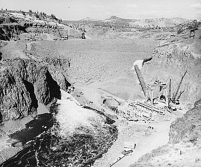
Iron Gate Dam
Iron Gate Dam, pictured here under construction in 1961, is one of seven dams on the Klamath River used by the Department of Interior’s Klamath Reclamation Project, which …
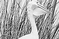
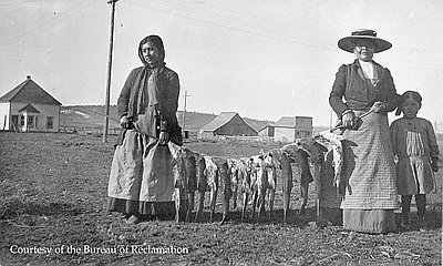
Return of the C'wam
For thousands of years, the Lost River suckers and shortnose suckers have been important to the Klamath Indian culture and, more so than salmon, essential to their subsistence. …
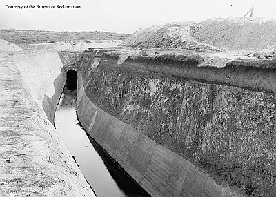
Klamath Project Canal & Tunnel
Construction of the Klamath Reclamation Project, a federally constructed and managed irrigation system, began in 1906 with the building of the Main Canal, or “A” Canal, and tunnel. …