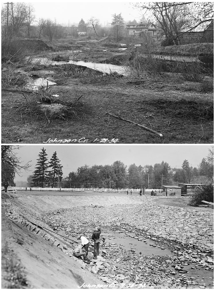
These photographs show two contrasting views of Johnson Creek. The top photograph, dated January 29, 1934, was taken just prior to the start of flood control work on this unidentified location. Homes are visible abutting the meandering creek’s eroding yet vegetation-filled banks. The bottom photograph, dated November 26, 1934, shows workers lining a nearby section of the newly cleared, widened, and contoured channel with riprap stonework—a strategy undertaken to reduce soil erosion during future floods.
Johnson Creek originates in the Cascade foothills and travels eighteen miles westward to the Willamette River. Semi-impermeable clay soils south of the creek intensify flooding during heavy rains. North of the creek, porous soils have historically allowed for the absorption of enough rainwater to sufficiently recharge the creek during dry summer months. As settlement increased during the nineteenth and twentieth centuries, many homes and businesses were built in the creek’s floodplain. As urban development increased within the creek’s fifty-four square mile watershed, much of the available water-permeable land surface was covered over, resulting in increased flooding. During the Great Depression efforts were undertaken to attempt to abate the worst of the flooding by remaking the creek into an open-aired storm drain.
Flood control work on Johnson Creek began during December, 1933, with federal funding from the Civil Works Administration and State Emergency Relief Act. By January, more than 300 workers were busy straightening and widening the creek’s channel and removing debris from a quarter-mile section near SE 92nd Avenue. By May, roughly 650 men were employed at various points along the creek. Some installed a 1,600-foot water-diversion pipe along the creek near SE Foster and 112th Avenue, while others transformed the creek into a simplified channel designed to efficiently guide high waters past flood-weary farmers, truck gardeners, and other creek-side property owners. At bends and near bridges, workers reinforced the creek walls to protect them from being damaged and eroded by debris moving downstream. By mid-November of 1934, after heavy rains failed to produce damaging floods, the effort was prematurely hailed as a success. However, over the following decades, the resurfaced and channelized portions of the creek were discovered to be exacerbating flooding along other sections of the creek.
Written by Joshua Binus, © Oregon Historical Society, 2004.