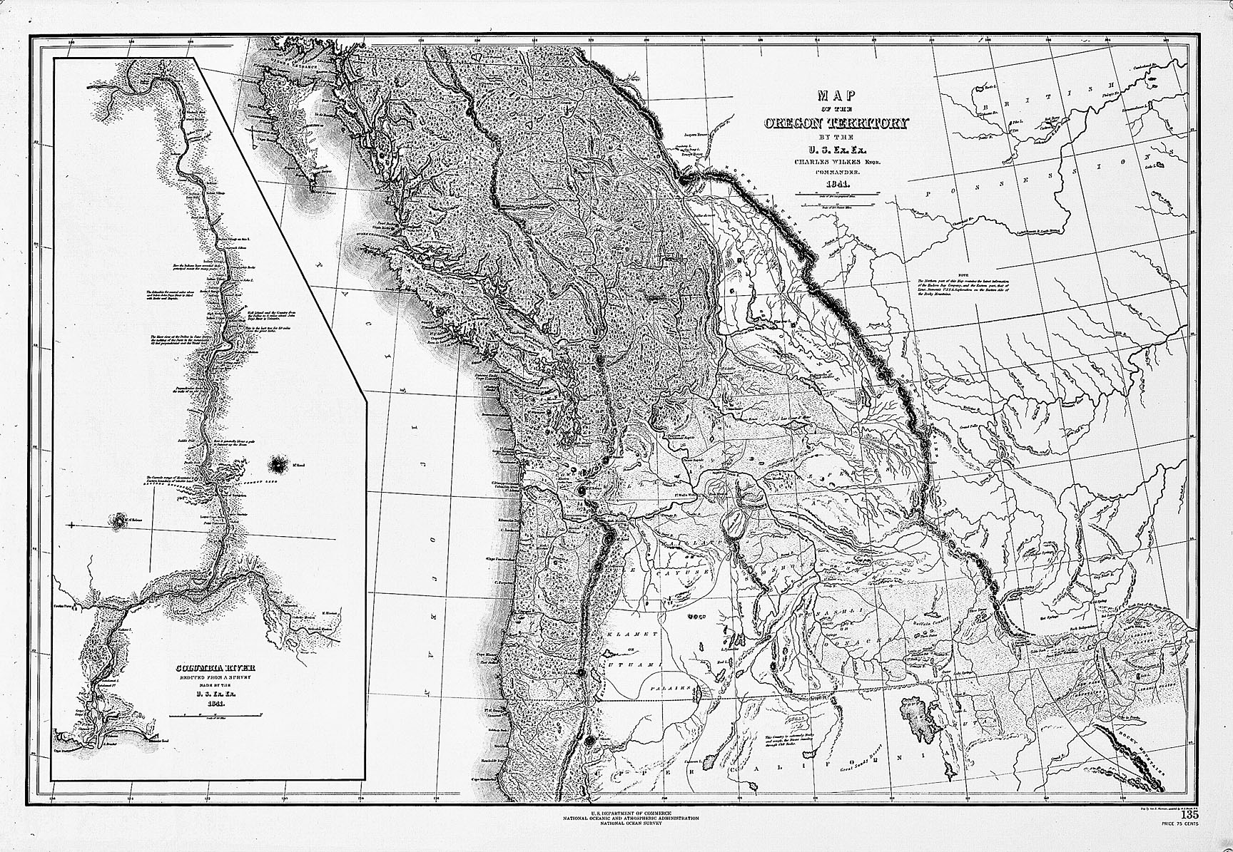
In 1841, Lt. Charles Wilkes, commander of the U.S. Exploring Expedition, sailed to the Pacific Northwest and began to explore the geographic region known as Oregon Country, which included land that would later be divided into the U.S. states of Idaho, Oregon, and Washington. Wilkes and his crew members, mostly members of the U.S. Navy, who were funded by the U.S. Congress, embarked in 1838 on a four-year mission to obtain commercial and scientific knowledge as the nation’s first maritime expedition.
The expedition members included a botanist, a naturalist, and a geologist, who gathered information about Native peoples and documented the plant and animal species of the places they visited. They mapped and surveyed Antarctica and South Pacific Islands before being ordered to travel to the Pacific Northwest, in part to help solidify the American claim to the region. Wilkes sent two ships to the Columbia River and sailed with two others to the Puget Sound, where he then led an overland journey south to the Columbia River and Willamette Valley. Expedition members received help and information from employees of the Hudson’s Bay Company, a British fur-trading company that established Fort Vancouver in 1825 as the headquarters of its Columbia region. In 1846, American and British representatives agreed in the Oregon Treaty of 1846 upon the 49th parallel as the border between the United States and Canada.
Further Reading:
Buerge, David M. “The Wilkes Expedition in the Pacific Northwest.” Columbia Magazine 1:1, 1987: 17-32.
Written by Kathy Tucker, © Oregon Historical Society, 2002.