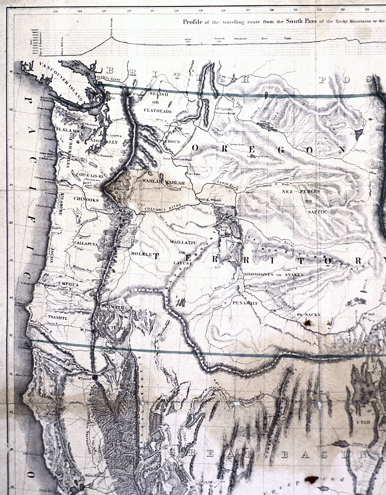
Charles Preuss, a German-born surveyor and cartographer, drafted this map of Oregon and California following the completion of John C. Frémont’s second expedition (1843-1844). Preuss based the map on his own notes as well as Frémont’s surveys. The map was later engraved by the lithography firm of E. Weber and Company, located in Baltimore.
Frémont’s second expedition, charged with completing a survey of the Oregon Country and the Oregon Trail for the U.S. Topographical Corps, departed western Missouri in the spring of 1843. The party of thirty-nine men included French American voyageurs, Anglo American fur traders, and young American men from both the eastern and western regions. After some six months on the overland trail, the party reached the Columbia River in early November 1843. While the main body of the expedition remained at The Dalles, Frémont spent several days replenishing supplies at Fort Vancouver. Rather than making a timely return to the United States via the Oregon Trail, Frémont decided to strike south through California before turning eastward. This route took the expedition through central Oregon along the Deschutes River, thence into the Klamath Basin and California.
Although this map provided some information on the Native geography of central Oregon, Frémont’s primary interest was evaluating the region with regard to Euro American colonization.
As his expedition report demonstrates, Frémont was more concerned with documenting the region’s natural resources than with the society and culture of the indigenous inhabitants. The explorer was particularly struck by the numerous falls in the Deschutes River watershed, its volcanic landscapes, pine forests, and the snowy peaks of the Cascade Range. In early December 1843, as the expedition left the Deschutes and journeyed toward the Klamath basin, Frémont recorded his impressions of the region. He noted:
...the great beauty of the country in summer constantly suggested itself to our imagination; and even now we found it beautiful, as we rode along these meadows . . . the rich soil and excellent water, surrounded by noble forests, make a picture that would delight the eye of a farmer.
Further Readings:
Frémont, John Charles. Narratives of Exploration and Adventure. Edited by Allan Nevins. New York, N.Y., 1956.
Goetzmann, William H. Army Exploration in the American West, 1803-1863. New Haven, Conn., 1959.
Written by Melinda Jette, © Oregon Historical Society, 2004.