These are just a few of the over 25,000 maps held by the Oregon Historical Society Research Library.
The Oregon Historical Society is the owner of the materials in the Research Library and makes available reproductions for research, publication, and other uses. Written permission must be obtained from the Research Library prior to any use of reproductions. The Society does not necessarily hold copyright to all of the materials in the collections. In some cases, permission for use may require seeking additional authorization from the copyright owners.
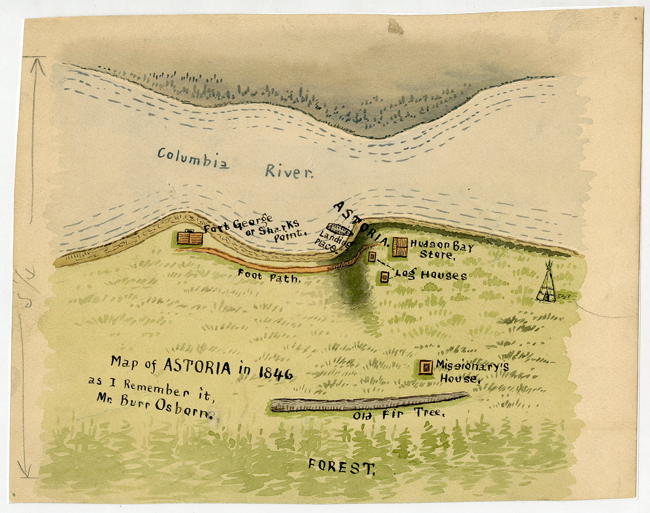 |
Map of Astoria, 1846: The maker of this map, Burr Osborn, survived the 1846 wreck of the Shark, a U.S. Navy schooner, in the dangerous waters of the Columbia Bar. The ship was lost, but the crew survived, spending several months in Oregon Territory. This map was likely made from memory many years later. | |
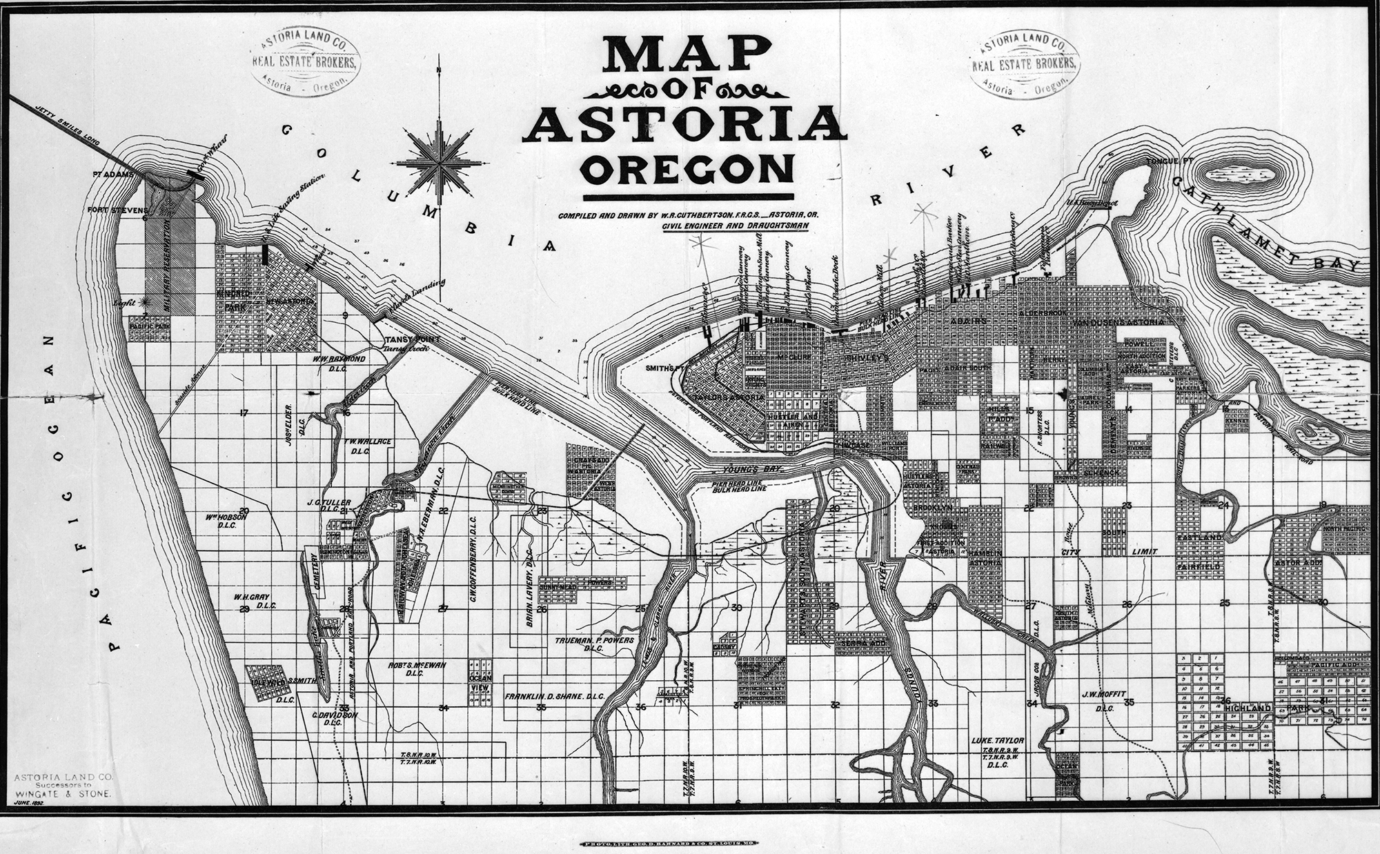 |
Map of Astoria, 1892, published by the Astoria Land C | |
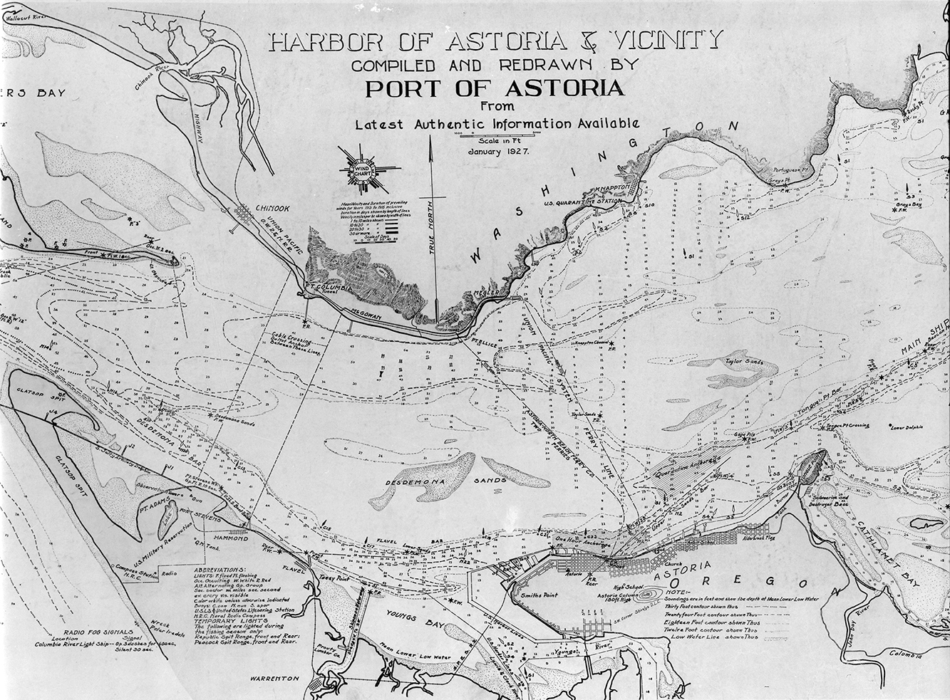 |
Harbor of Astoria, 1927 A map drawn by the Port of Astoria, including a wind chart. |
|
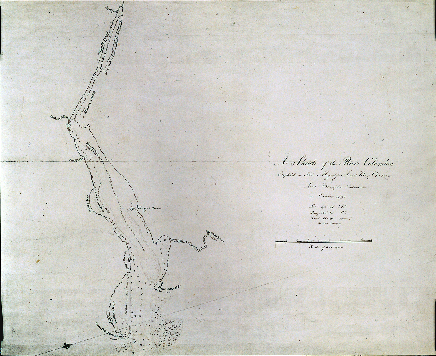 |
A Sketch of the River Columbia, 1792 A Sketch of the River Columbia, 1792, by Lt. William Broughton, part of Vancouver's Expedition. |
|
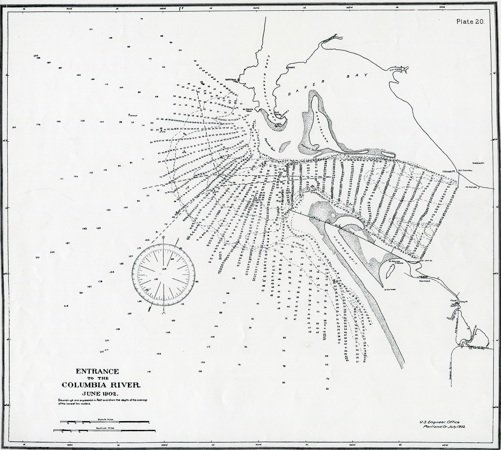 |
Entrance to the Columbia, 1902 Mapping of soundings, measured in feet, of the mouth of the Columbia River. Published by the U.S. Engineer Office, Portland, 1902 |
|
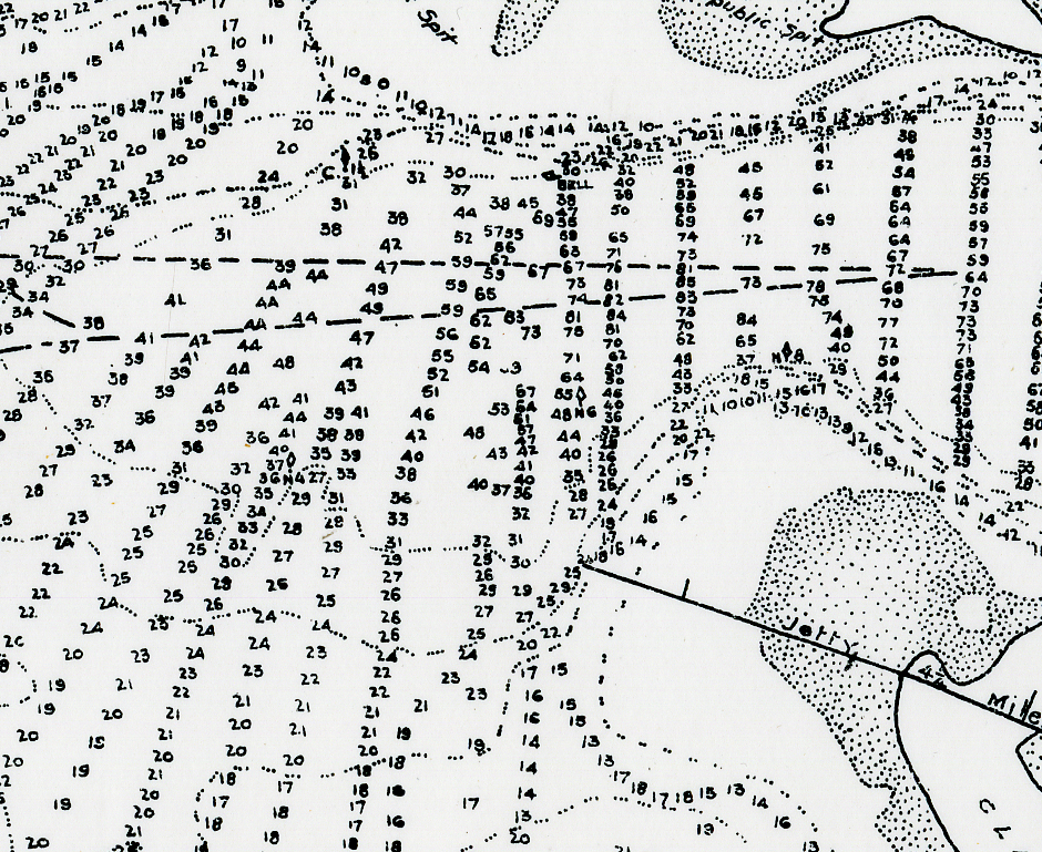 |
Entrance to the Columbia, 1902, detail | |
 |
Aboriginal Map of North America, 1857 The British government commissioned this map to mark the boundaries of identified Indian tribes, including those which had already been removed from their land in the East to lands in the West and those which had been made extinct by disease, war, and resettlement. The newly formed reservations in Oregon Territory (1855) are not yet marked on this map. |
|
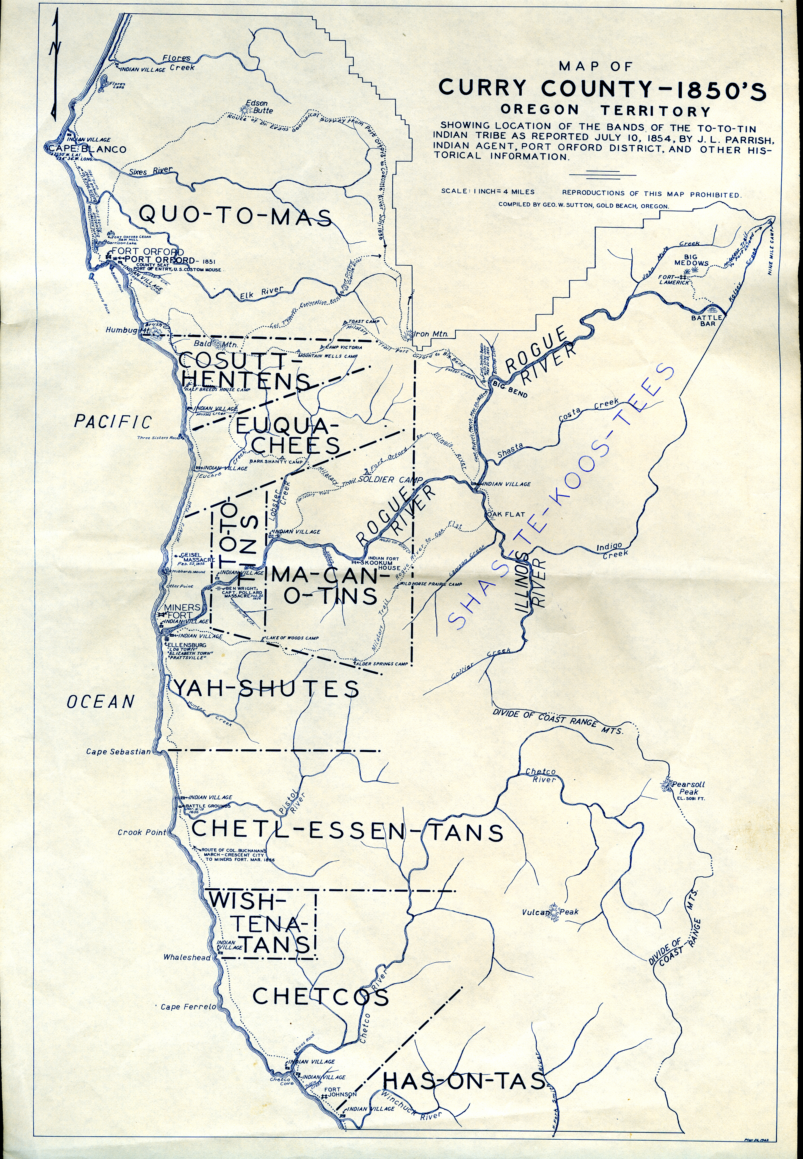 |
Indian Bands in Curry County, 1850s Map of identified Native communities in Curry County; the county was created in 1855. Reverend J. L. Parrish was a missionary who arrived in Oregon in 1840 by ship. He served as an Indian agent from 1849 to 1854 on the Clatsop Plains. |
|
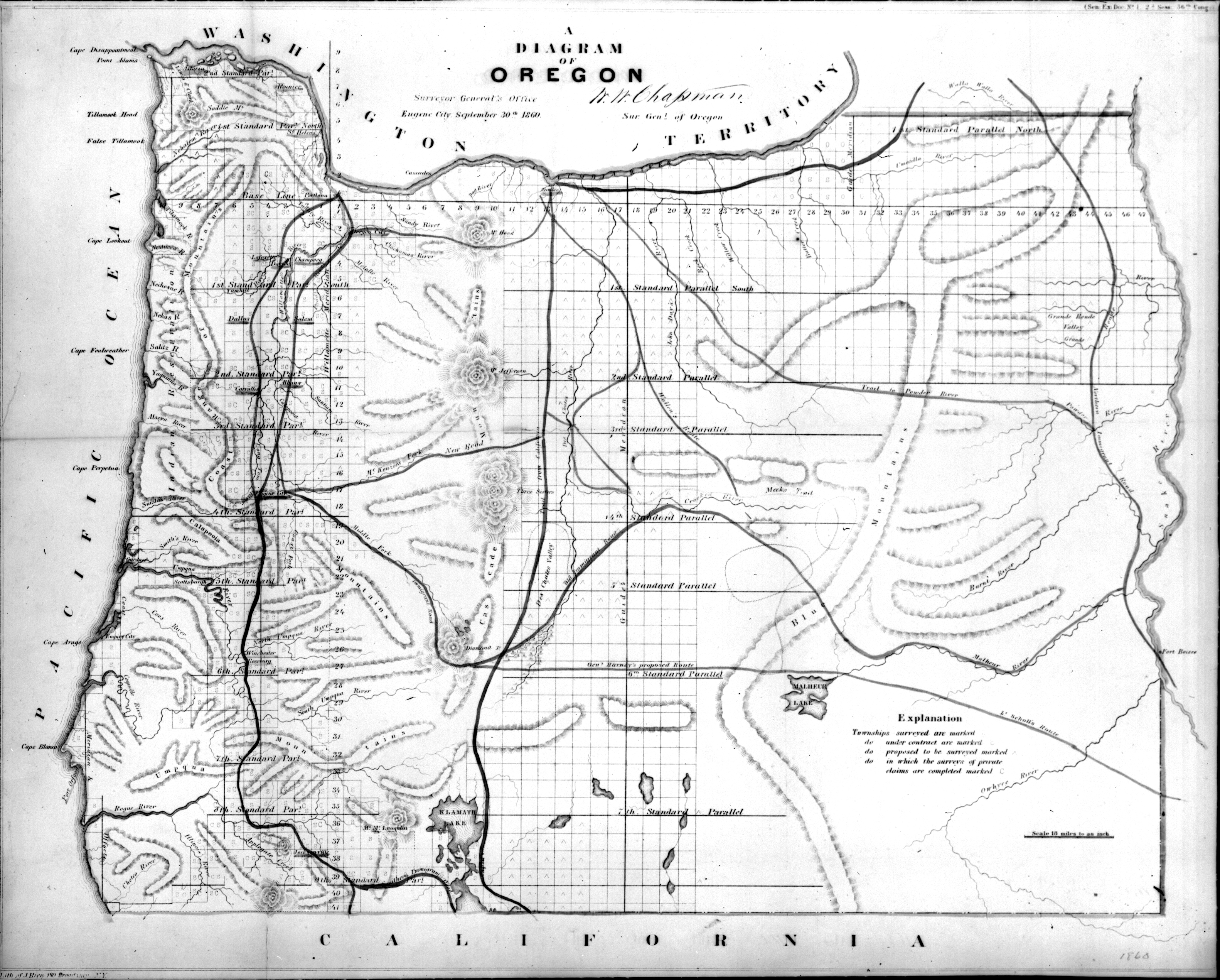 |
Diagram of Oregon, 1860 A map of Oregon commissioned by the Surveyor General's Office, showing town sites and major topographical features. |
|
 |
Diagram of the Reservations, 1864 Diagram of the Reservations and Tracts of Land Purchases from the Various Indian Tribes in Oregon. This map was created by the Superintendent of Indian Affairs in Oregon. |
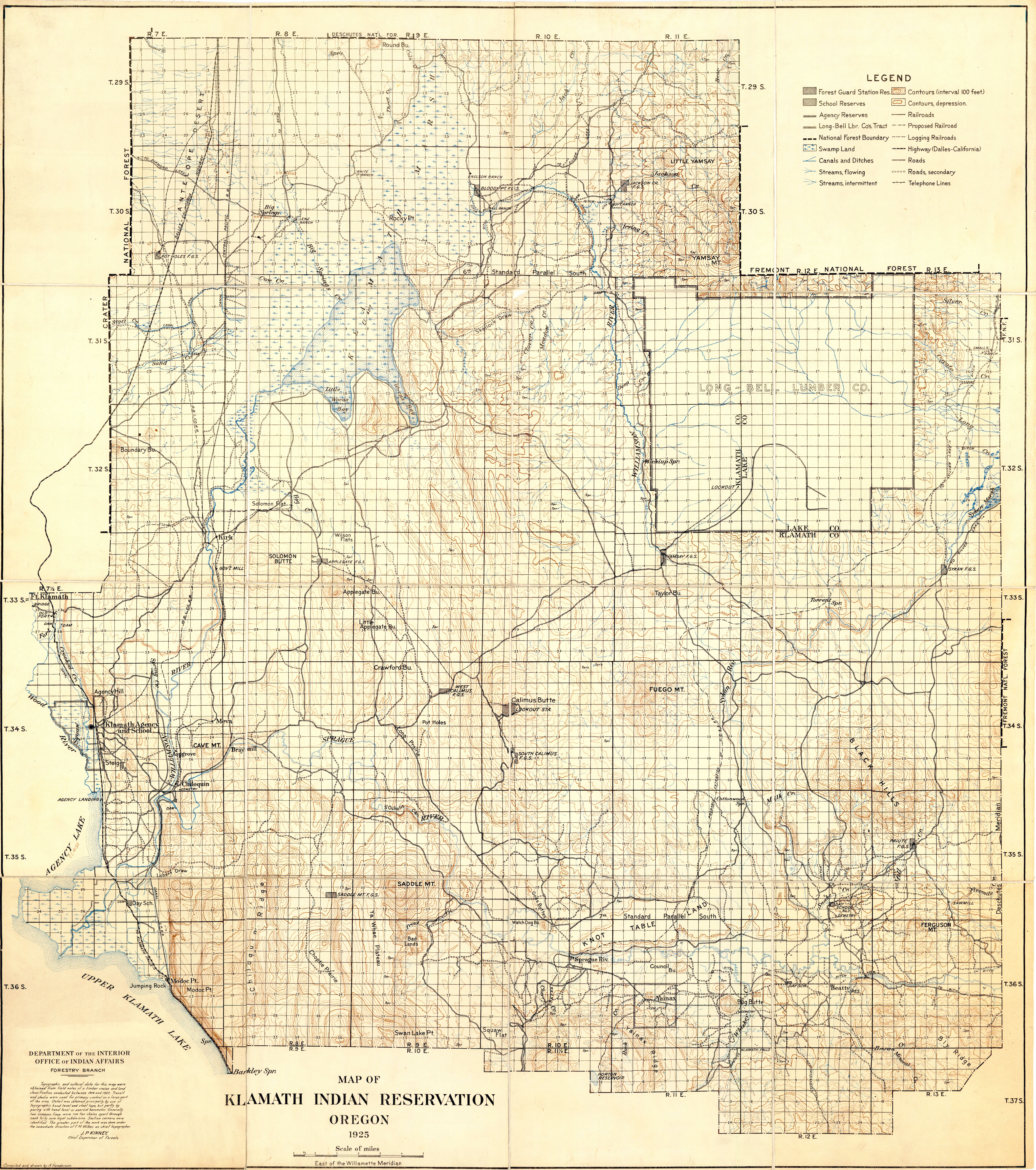 |
Klamath Indian Reservation, 1925 This detail map of the Klamath Indian Reservation was created by the U.S. Department of the Interior, Office of Indian Affairs, Forestry Branch. |
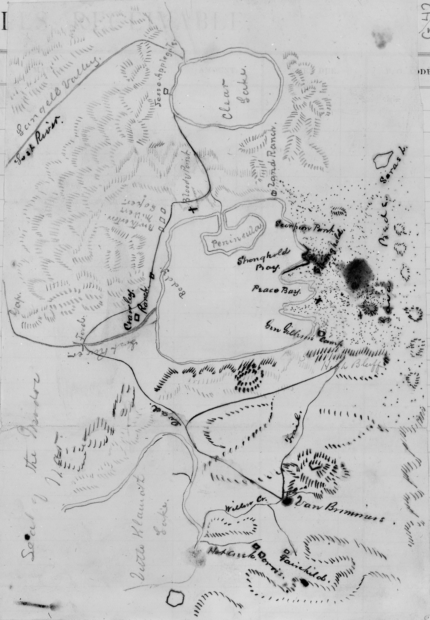 |
Seat of the Modoc War, 1873 (?) This hand-drawn map of the site of the Modoc War was made by an unknown person. Both landmarks and army camp sites have been identified, including the Modoc stronghold and Gen. Gillem's camp. |
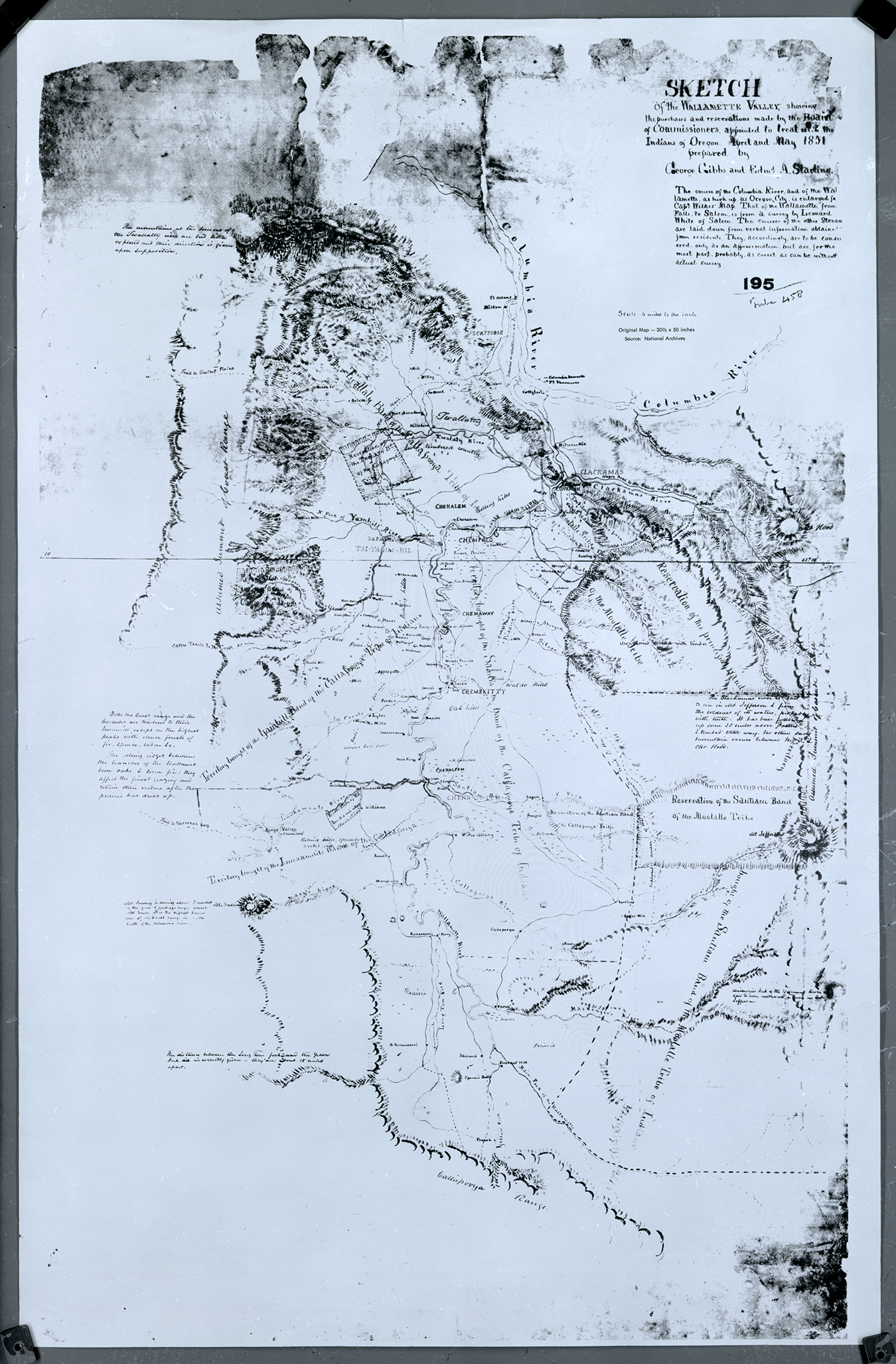 |
Sketch of the Willamette Valley, 1851 Sketch of the Willamette Valley, showing the purchases and reservations made by the Board of Commissioners appointed to treat with the Indians of Oregon April and May 1851, prepared by George Gibbs [governor of Oregon] and Edward A. Starling. |
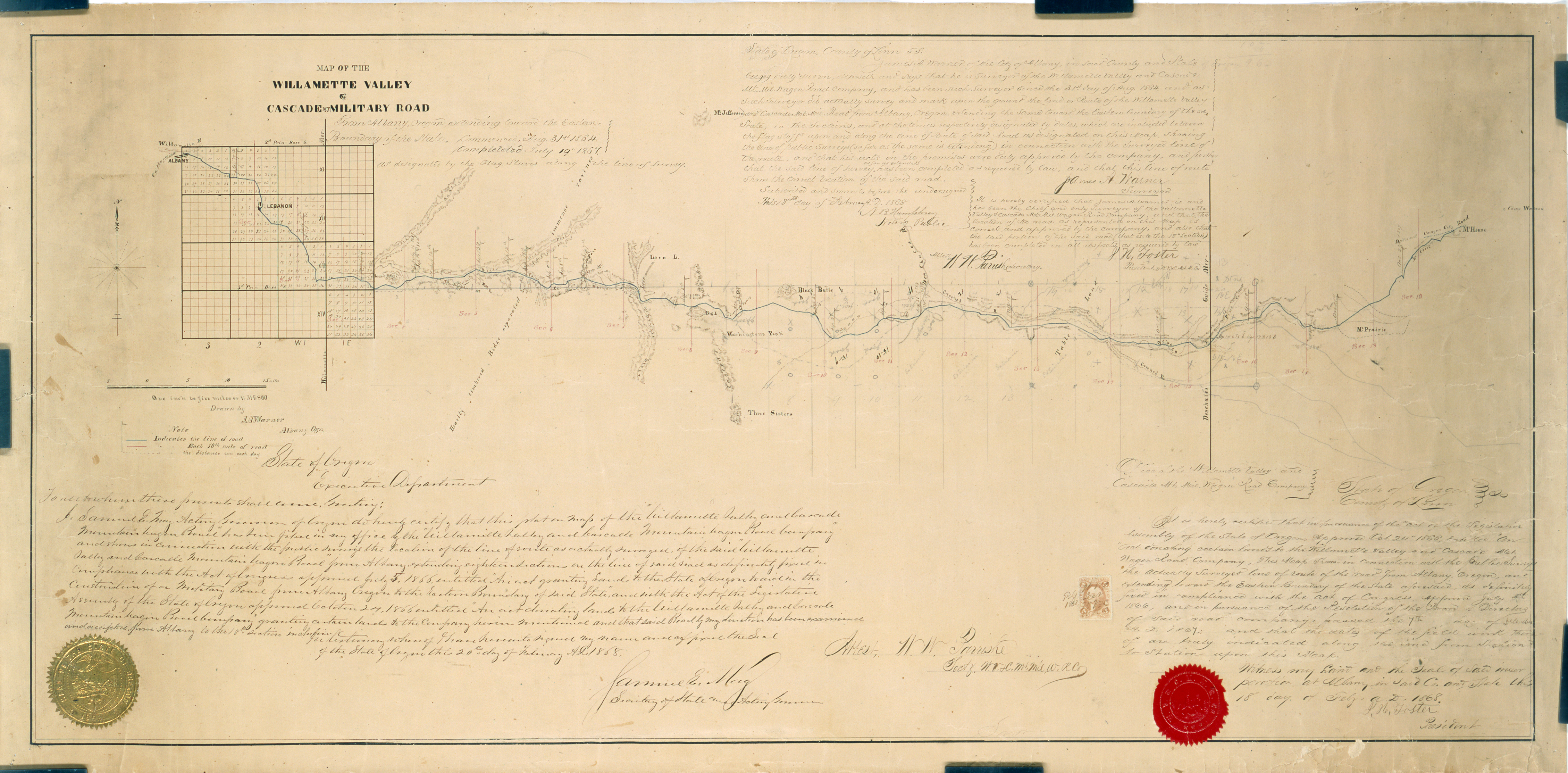 |
Map of the Willamette Valley and Cascade Mt. Road, 1868 Created by Oregon's Secretary of State, Samuel E. May, in 1868. |