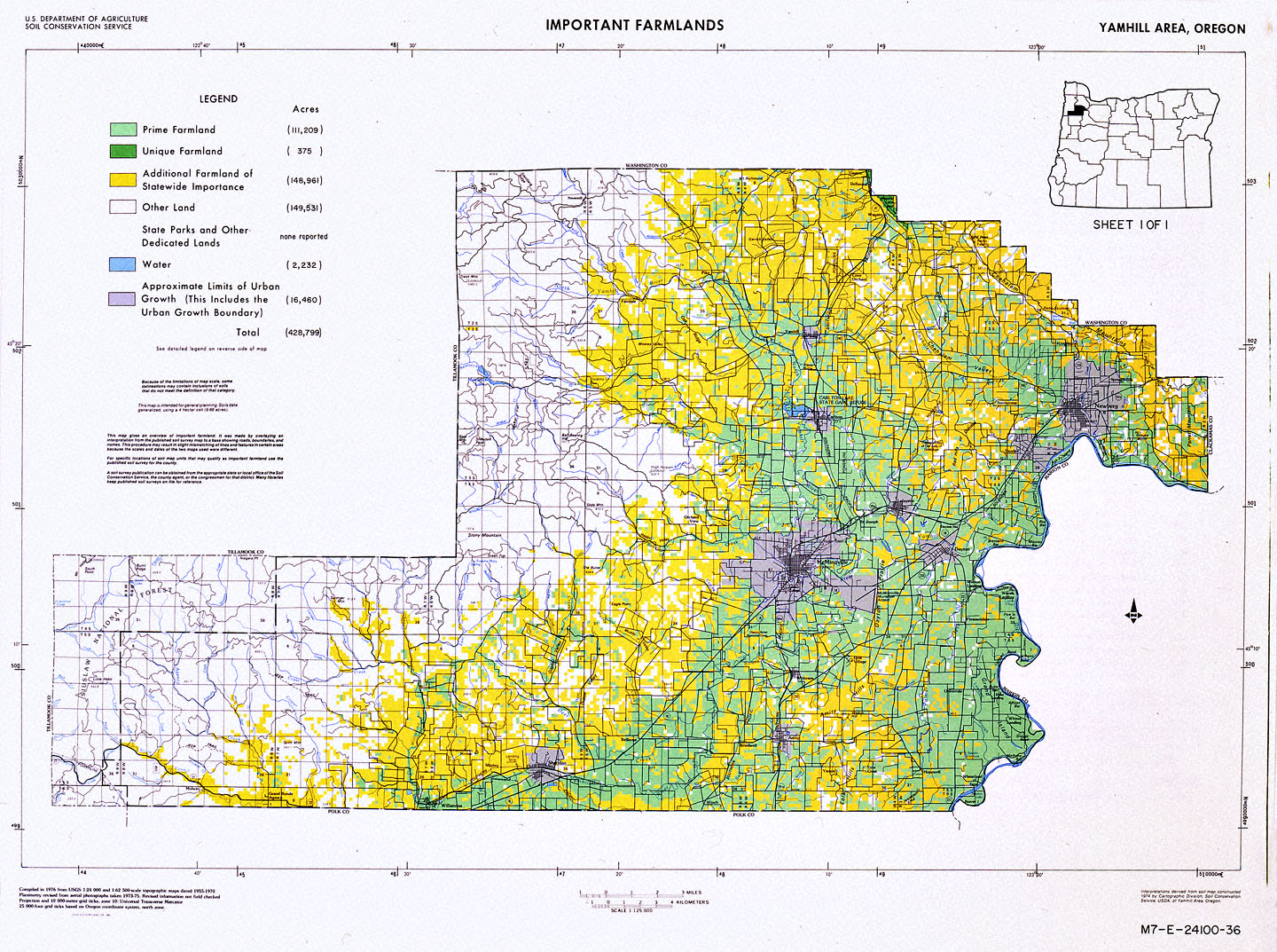
The U.S. Department of Agriculture and the Soil Conservation Service published this 1980 map showing designated farmland and urban growth boundaries in Yamhill County.
In 1973, the Oregon State Legislature passed a land-use planning law requiring all counties to develop growth-management plans that met a series of statewide goals, including citizen involvement, preserving agricultural and forest lands, energy conservation, and concentrating developments within urban growth boundaries. Republican State Senator Hector Macpherson, a third-generation Linn County dairy farmer, helped sponsor the legislation after becoming alarmed at increasing developmental sprawl.
Despite objections from some businesses and land owners, Governor Tom McCall signed Senate Bill 100 into law and defended the controversial legislation. Since then, voters and the courts have rejected several initiatives aimed at dismantling the law.
Oregon’s population grew tremendously during and after World War II, increasing from 1,089,684 in 1940 to 1,768,687 in 1960. Since 1960, Yamhill County’s population more than doubled in population, growing from 32,478 to 84,992.
Further Reading:
Abbott, Carl and Deborah Howe. “The Politics of Land-Use Law in Oregon: Senate Bill 100, Twenty Years After.” Oregon Historical Quarterly 94, 1993: 4-35.
Written by Kathy Tucker, © Oregon Historical Society, 2002.